The Province’s roads
In recent years studying the history of the roads of Gipuzkoa has become one of most fruitful areas of historical research.
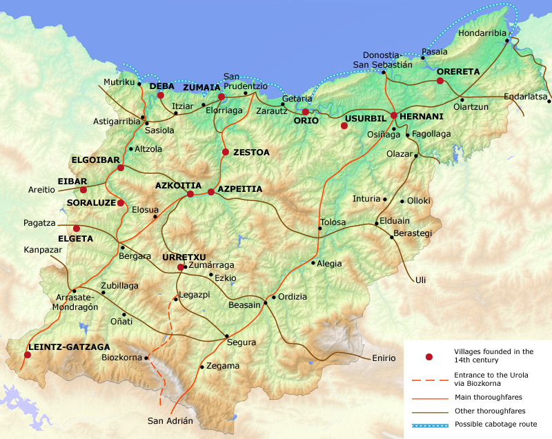
Until the development of the villas at the end of the 13th century, there was a network of paths that centred on joining Bajo Oria and Urumea with Navarra, mainly via the Sierra Aralar, from which communications spread out via the mountain passes towards the coast via Andatzarrate and to Bergara via Goierri and Alto Urola. The roads generally followed the migratory routes of livestock. There were also paths between valleys, flanked by castles, where Roman remains have been found.
The founding of the villas at the end of the 13th century created two main north-south axes between the coast and Álava, which was the road to Castile. For the most part they followed the route of two valleys and spread out through the villas: from Arlaban to Bergara and from there to Mutriku and Zumaia-Getaria via San Prudencio (Deba valley); from Biozkorna to Legazpi, and from there through the Oria valley towards the coast. These axes did not replace the old ones, which remained, although less used and not so well maintained. In this manner the transport network spread out in the same way as the provincial institutions, bringing together the different areas.
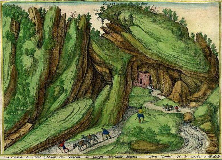
This process reached a peak in the middle of the 18th century with the construction, partly financed by Gipuzkoa of the new royal coach road which crossed the province diagonally (south-west, north-east) and joined Arlaban with Irun. The original route, as mapped out by the architect Ibero, joins Gatzaga to the Leintz valley and upper Deba and, via Oñati-Legazpi-Zumarraga and went as far as Goierri. However, this was replaced by another route considered most suitable for wheeled traffic, which ran from the port of Deskarga to Zumarraga. As well as being more convenient, this route served the trade between Bergara and Arrasate. On the other hand, the stretch San Adrián-Igartza, which crosses the Sierra Aizkorri and came down by the High Oria to Beasain remained outside of these plans and was categorized as a post road. In Beasain the old Oria road was picked up to Tolosa, passing through Urumea and via Urnieta to Astigarraga, and from Oiartzun to Irun. It crossed the Bidasoa at Behobia.
The coach road did not reach Donostia, or not as such, given the difficulties of the terrain and it is joined by a diversion via Hernani. There was a plan for the branch road from Tolosa towards Navarra. Another branch joined Bergara with Mutriku-Deba, following the old valley road. For the most part this road still exists. The biggest change, which happened much later, was to bring the stretch from Otzaurte, which went down from Navarra to Zegama (Upper Oria), into the main network.
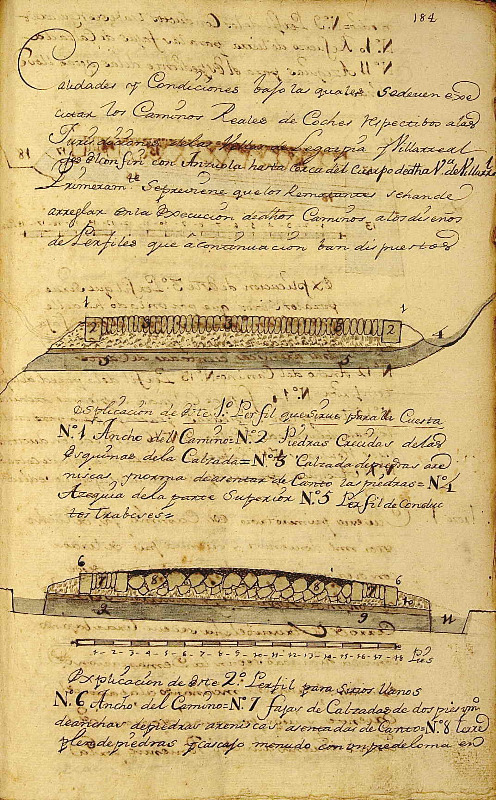
This road was out of bounds to carts with studded wheels, because of the damage they caused to the mud and the mountain. The project was publicly funded via taxes imposed on the merchandise that travelled along the roads and by the Diputación. There were also tolls charged in which signs of two remain at the entrance to Irun from Oiartzun before turning off towards Hondarribia, and in Beasain where the Upper Oria and Upper Urola roads come together. There was a strict maintenance regime.
This road can be seen as a project that is representative of the local enlightenment, which saw it as the father who was going to fertilize the mother (the Province) through the trade generated along it.

